随着国土空间规划体系逐步建立,总体规划向详细规划的传导落实进入关键阶段。如何优化空间布局、提升空间运行绩效,并提前识别潜在的发展风险,成为规划编制与实施管理中的重要问题。
城乡空间中存在着多维度、相互交织的供需关系:既包括人口、就业、商业、公共服务、交通与生态等要素之间的功能匹配,也包括各类活动需求与相应用地供给之间的空间匹配。传统主要依赖经验判断的规划方法,难以系统识别空间方案背后的效率、公平、低碳与安全影响。
围绕这一问题,我们构建了面向空间布局优化的智能规划模拟评价系统——SimPlan。
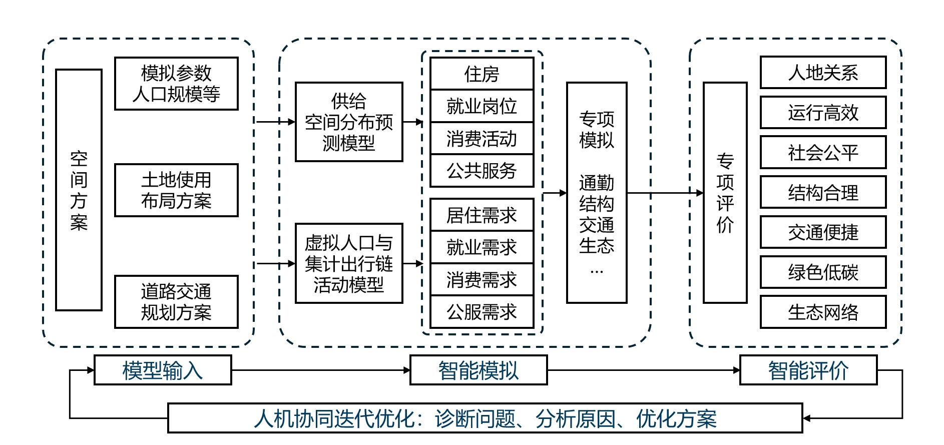
与许多规划支持系统(Planning Support System)一样,SimPlan的核心目标不是预测未来,而是通过可解释的模型和多维评价,为规划师、政府部门和利益相关者之间的讨论提供定量证据。系统以土地使用方案、开发强度、道路交通网络和规划参数为输入,模拟城市活动、供需关系与空间运行结果,并将评价结果反馈给规划方案优化过程。
As China’s territorial planning system continues to take shape, optimizing spatial layouts, improving urban performance, and identifying potential development risks have become key challenges in planning and implementation.
Urban and rural spaces involve complex supply–demand relationships. Conventional experience-based planning methods are often insufficient to systematically assess the efficiency, equity, low-carbon, and safety impacts of spatial plans.
To address this challenge, we developed SimPlan, a simulation-based planning support system. Like many Planning Support Systems, SimPlan is not designed to simply predict the future. Instead, it provides quantitative evidence for planners, governments, and stakeholders through interpretable models and multi-dimensional evaluation.